|
|
|
|
 |
|
|
|
|
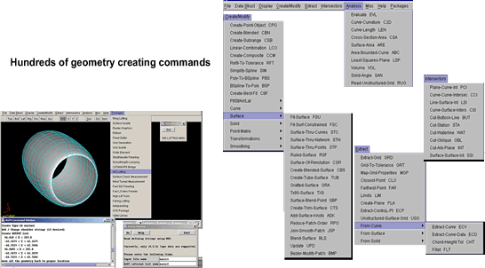
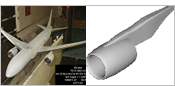
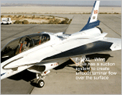
AGPS contains surface geometry creation capabilities far beyond what is available in any commercially available CAD system.
Create accurate surface geometry -- access to the mathematical foundation of geometry -- extract and analyze geometric information. |
|
|
|
|
|
|
|
|
|
|
|
|
|
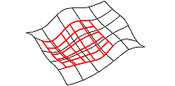
| Advanced
surface technology |
|
|
|
| Commands
that easily handle any complex geometry creation problems. |
|
|
|
|
Strings of data points
Arrays (point meshes)
Lattices
Point Matrix
Flight Path Array
|
|
|
|
|
|
|
|
|
Constrained Curves
Curves with slope discontinuities
Conic sections
Concatenate curves
Sub-portion of a curve as a curve
Modify an existing curve
Create fillets
Map curve to surface
Ellipse
|
|
|
|
|
|
|
|
|
|
|
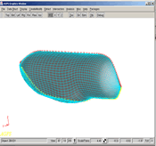
Smooth surface from an array
Surfaces with slope discontinuities
Surfaces from curves
Concatenate surfaces
Sub-portion of a surface as a surface
Create fillets between surfaces
Surfaces through scattered points
Surface between surface and given point
Trimmed Surface
Grafted Surfaces (Merge Blisters)
Surface of Revolution
Cubic Surface Blending
Tube Surface
Ruled Surfaces
|
|
|
|
|
|
|
|
|
Defining a solid from a lattice of points
Defining a solid from a series of curves or surfaces
Defining a sub-portion of a solid as a solid
|
|
|
|
|
|
|
|
|
|
|
Specified or equal arc length spacing
Extract Grid
Specified or equal parametric values spacing
Using a chord height tolerance
Digitizing from a screen display
Extract curve, data, derivative, tangent, and curvature information
Closest point on a curve to a given point
Farthest point on a curve from a given point
Minimum or maximum X, Y, or Z
|
|
|
|
|
|
|
|
|
|
|
|
Extract Grid
Specified or equal arc-length spacing
Specified or equal parametric spacing
Extract surface, data, normal, tangent, and curvature information
Digitizing from a screen display
NC data (points and normals) for Wind Tunnel models
Closest point on a surface to a given point
Farthest point on a surface from a given point
Minimum or maximum X, Y, or Z
|
|
|
|
|
|
|
|
|
|
|
|
Create Subrange (Parametric Map)
Piece Objects Together (Composite)
Enrich Strings
Transpose Arrays
Interactively modify a point
Point and mesh (array) smoothing
Obtain Surface Connections
Add Surface knots
Add Curve knots
Concatenate curves
|
|
Trimming Surfaces
Convert B-Splines -Polynomials
Sorting points
Map points to another object
Tangent point along a curve
Transformations
Blend Surfaces
Smoothly join curves
Reverse Curves
Connectivity between curves
|
|
|
|
|
|
|
|
|
|
|
|
Curvature of a curve or surface
Find Slope of a curve
Normals to a curve or surface
Curve Length
Cross-sectional Area
Enclosed area of a curve
Volume and Centroid
Plane tangent to a point on a surface
Solid angle
Least squares plane
|
|
Least squares point passing through a system of planes
Plane normal to point on a curve
Geodesic curve on a surface
Line and surface intersection
Plane and surface intersection
Surface-Surface intersection
Curve and surface intersection
Plane and curve intersection
Curve-Curve Intersection
|
|
|
|
|
|
|
|
|
|
|
|
Previously saved AGPS session
Strings of data
Arrays of points
IGES and STEP formatted files
A502 input deck
GGP and ESA files
PLOT3D files
Structured/Unstructured Grids
|
|
|
|
|
|
|
|
|
|
|
AGPS Data Structure
In-house Formats
Strings of points
Arrays of points
IGES and STEP
Analysis Input Decks
PLOT3D
Text Data
Geodesic data
NC data for windtunnel models
|
|
|
|
|
|
|
|
|